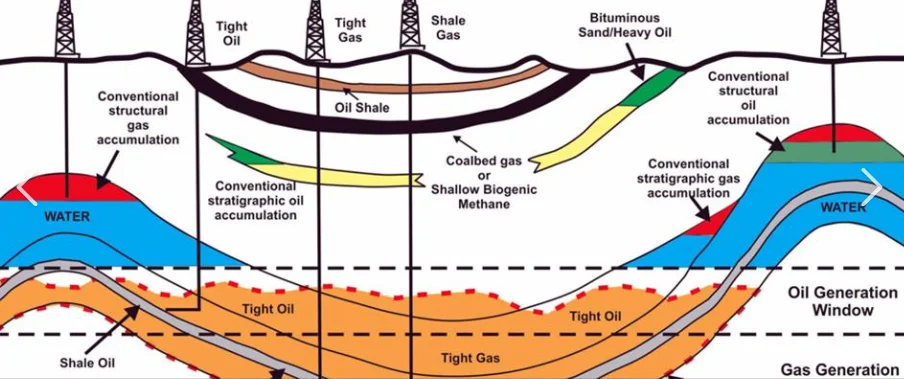
OIL AND GAS
 Business Development and New Opportunities

Detecting and Evaluating Contemporarily Opportunities
More info
- Presenting current opportunities and available teasers - Conducting market researches and directly connecting business channels -Coordination between legal entities for Data purchasing and trading

New Ventures and Bid Round Campaigns Evaluations
More info
Data packages selection criteria and evaluation. Efficient work flows to accelerate the screening and evaluation during data rooms events. Post event potentialities evaluation and recommendations. Prospectivety mapping in short term assessment phase. Expressing knowledge into business values. Risk assessment and applications of risk variables. Full G&G report manufacturing and presentations. Proposals smart offering and mitigating crucial constraints.
 Geo-Commercials and Management Advisory
Assets' Appraisals and Marketing
More info
A new look into the subsurface setting of your fields might change the vision of investment. Innovated work flows can come with more potential results. Keen search in data libraries can add more values to the subsurface reserves. High reaching investors channels. Well presenting data room presentation and hosting

Governmental and Corporates Relationships Coordination
More info
During phases of evaluation, proposals preparation, negotiations, legal documentations, security and authorities approvals

Conducting Technical Assists' Peer Reviews
More info
Pre-TCM preparation of reports and presentations. Participating and supporting technical teams with multi experienced SMEs with high skills of communications and negotiations. Internal peer reviews to escalate higher levels of brain storming and out of the box ideas.

Technology Markets Surveying for Best Practices and Prices
More info
Finding best practices in local and international markets to meet your needs in software licenses, logging equipment, measurement tools, lab analysis, providing vendors and comprehensive price listings
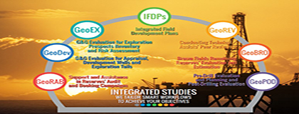 Integrated Studies

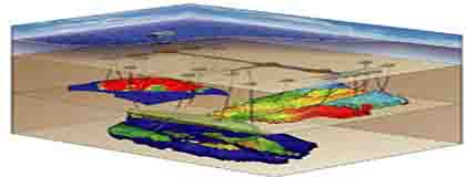
IFDPs: Integrated Field Development Plans
More info
Teams of specialists, to manage and integrate the subsurface and surface complexities, uncertainties and opportunities into a consistent development plan, maximizing the field recovery and asset value, and minimizing risks. Integrated work flows for each sub-division in G&G and engineering fields.

GeoEx: G&G Evaluation for Exploration Prospects Inventory and Risk Assessment
More info
Multi-experienced team of geoscientists skilled to conduct G&G exploration studies, providing full exploration plan including prospect ranking, volumetric calculations, risk assessment, and data acquisitions

GeoDev: G&G Evaluation for Appraisal, Development Wells and Exploration Tails
More info
Experienced geoscientists and engineers in development wells planning and exploration tails evaluations. Enhancement of oil recovery and reserve assessments studies conduction at high level of industry standards and with out standing professional investigations. Minimizing risk for drilling and production and increasing assets value

Brown Fields Remaining Reserves' Evaluation and Estimation
More info
Introducing accurate estimates of all remaining reserves in old producing fields. Presenting available extensions of subsurface reservoirs and ranking the resources as for real economic values. Recommending alternative business scenarios against life time of the field. Coordinating between auditors and company during technical discussions and reserve estimates negotiations

Asset Assessment and Reserve Booking Campaigns
More info
Providing technical advisory prior to reserve booking campaign. Preparation of full field appraisals reports that can cover the technical concerns during the campaign. Presenting in peer reviews as third party technical advisor.

GeoPod: Pre-Drill Assessment and Planning and Post Drilling Appraisal and Evaluation
More info
Providing quick look subsurface evaluation of well recommendation prior to spudding. Recommending alternative plans to reduce risk of drilling. Drilling program evaluation and recommendations. Covering full technical support during drilling. Providing urgent decision trees in missed targets or operations failure cases. Assessment of drilling results and updating G&G models. Delivering post drilling appraisal reports.
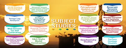 Subject Studies
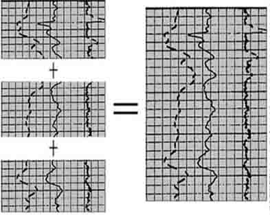
2D/3D Structural and Stratigraphic Seismic Data Interpretation
More info
A full conventional and un-conventional seismic interpretation techniques are available by our SMEs of seismic interpretation. Highly skilled interpreters who can immediately start working on any geosciences software are ready to provide outstanding results. long experienced in working in the most complex basins in Egypt, Sudan, Yemen, Iraq, Libya, Algeria, Pakistan. We can cover any specific seismic interpretation scope of works
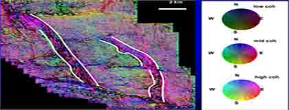
Seismic Attributes and In-house Seismic Data Enhancements
More info
Why to ignore the un-limited amount of info stored in your seismic cubes? We can provide you with the extracts of what seismic data contents can tell about the subsurface. Dedicated and smart work flows are designed to fit with your scope of work. Intensively work to enhance seismic data qualities are designed to achieve best practices of seismic attributes results. Both structural and stratigraphic seismic attributes routines are conducted at the utmost levels of parameters' optimization techniques
Advanced Seismic Interpretation Utilizing AVO, Inversion and Seismic Attributes
More info
Integrated and optimized combo volumes can add a lot to your subsurface models. AVO inversion techniques are conducted at high levels of desired details to figure out a quantitative evaluation for each reservoir of interest. All extracted volumes merged in applicable 3D visualization tools to navigate swiftly and with high confidence through your field subsurface models
Well-Seismic Tie and Calibration
More info
Basic and advanced seismic-well tie methods are applied including sorting and ranking of well data, VSPs, check shots or creation and editing new functions to optimize miss-tie application with the most accurate and minimum error criteria
Time Depth Conversion and Velocity Models Generation and Calibration
More info
Providing well designed depth conversion workflows and trials until reaching to the most accurate depth models. The analysis tarts with scattered data points to merging and calibrating velocity models that can be derived from different sources (stacking velocity, migration velocity, tomo iteration, ect...). Derived volumes are intensively examined through many blind well test exercises until achieving the most reliable velocity models
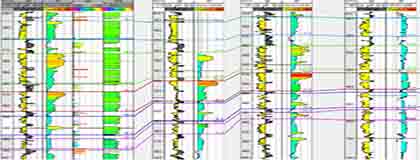
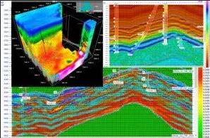
Geological Interpretation and Well Log Correlation
More info
Interpretation of e-logs to identify main geological markers, interpretation of structural events and stratigraphic features. Correlation between well logs to achieve valid conceptual models. Comprehensive cross sections to guide seismic interpretation in complex structures and bad quality seismic data sets

Image Log Interpretation
More info
Interpretation and analysis of basic and advanced image logs conducted by any vendor (SLB, HLS, Baker Hughes, ect.. ) to delineate the to achieve conclusions about bedding dip, fracture analysis, classification of rock texture and quantitative image analyses
Mapping Profiling and Geological Modeling
More info
Content and structure of legacy data sources are examined and understood in detail, and mapping specifications are produced for an objective transformation of the data from source to target.

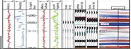
Petrophysical Analysis and Evaluation
More info
Highly skilled paraphysicists who can deliver deterministic evaluation of the physical properties of rocks and the fluids that they contain (clay volume, total porosity, total water saturation, mineral volumes,...). Ready to work on any geosciences software within the shortest turn around schedules and most optimized parameters at the highest levels of details.

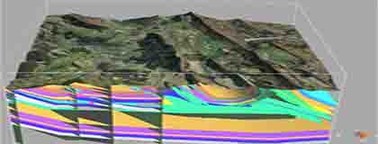
Geological Static Model Construction, Generation and Updating
More info
Construction of structural model, from geophysical and geological data, parameters selection and examination for model validity. Comprehensive distribution experiments to achieve reliable models. Generation of relevant outputs such as cross sections and volumetric estimates. Uncertainties displays and scenarios analysis
Reservoir Simulation and Dynamic Modelling
More info
Complex, conventional and unconventional, oil and gas reservoirs. Probability and determinism (reservoir model components). Property modelling. Dynamic model. Major laws used in reservoir simulation, Numerical techniques in reservoir simulation. Scale, Upscale. Pseudo. Effective property. Black oil model. Compositional model Outline

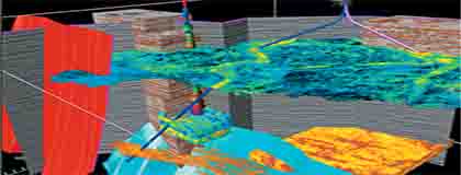
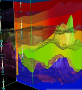
3D Visualization, Utilizing Conventional and Coherency Seismic Cubes
More info
Efficient workflows to generate well representative seismic data derived coherency, spectral decomposition and other sets of attributes. Utilizing best technologies to provide most reliable data driven imaging for structural and stratigraphic models.

Sedimentological Studies and Basin Analysis
More info
Basin analysis through integrated studies including subsidence, burial history, stratigraphic architecture, paleogeographic evaluation, geological data (outcrops, wireline logs, core) geophysical data sets, modeling and data analysis
Geochemistry Studies
More info
Studying the hydrocarbon generation, migration, and accumulation processes within a basin. Utilizing basin model data and subsurface measurements to generate a petroleum system model to minimize risk before drilling. Finding all possible scenarios of potential extensions of reservoirs around the field.

Surface Geology Studies
More info
Well prepared to organize field trips for analogue or learning purposes. Responsible to perform logistic and technical missions to cover an out standing field trips. Archiving full records in easy accessed databases. Correlating the surface outcrop maps with the subsurface geological settings. Affording highest levels of HSE. Providing state-of the art navigation equipment.
Gravity and Magnetic Processing and Interpretation
More info
Conceptual and detailed processing and interpretation studies are conducted by our experts utilizing higher algorithmic geosciences software to achieve accurate corrected data sets and valid models for subsurface depth to basement and layering details
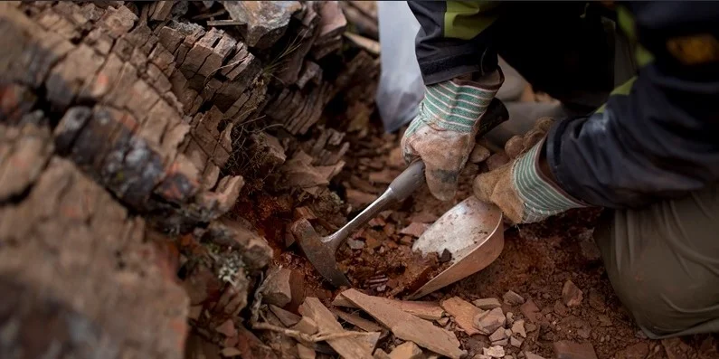
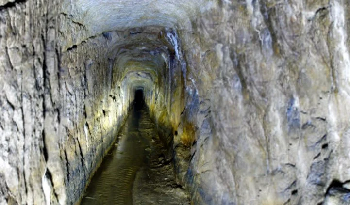
.jpg) Field Surveys and Visits
Field Surveys and Visits
.jpg)
QC/QA Geophysical Seismic Processing and Acquisition Surveys
More info
Providing highly skilled QC supervisors with national and international profiles, capable to manage and audit seismic acquisition operations and efficiently reporting routine and eventual events. Our QC processing expats are professionals with real hands on experience for more than 25 years in the field of seismic data processing, they participated in the development of many of technologies and workflows, professionally running peer-reviews with seismic processing teams and delivering optimized parameters for each step tailored to meet the objectives of the processing and reporting a full separate reports that covers all aspects of the project.

Well Site Surveying
More info
High quality surveying instruments are ready to move to your new wells location, to be utilized by experienced and professional surveyors to pick the nearest to zero errors of coordinates and presenting full reports covering all navigational, logistical, obstacles and terrain aspects

GPR and Resistivity Profiling Surveying for Well Site Preparation
More info
We are proud to introduce our ability to conduct shallow geophysical prospecting in well site location, to mitigate the hazards of burred tunnels, quarriers, pipe lines, caving, etc...
.jpg)
Well Site Geologist Support and Well Logging Witnessing and QC
More info
Well site engineers with various experience levels are ready to join your drilling program and provide support at any time prior, during or after drilling. They can introduce immediate recommendation for casing setting, logging programs, side track options. Fully responsible to deliver instantaneous reports during patch of service.

Field Database and Samples' Stores; Sorting, Arranging and Archiving
More info
Providing professional and well trained technicians who are capable to dynamically, sort, list, arrange, fix and report data samples ware houses in the field. Providing a smooth accessibility to your data samples storage and databases
 Data Libraries Processing and Operations
Well Log Edit, Splicing and Drafting, Data Scanning, Digitization and Vectorization
More info
Old sections and well logs, can regenerate valuable information to the present. We provide maintenance and repairing of teared sections, maps, logs, and documents at surgical qualifications. We are always keen to preserve and increase the values of your data assets, accordingly an immediate backup will be generated at the re-born of any damaged data

Database Sorting, Arranging of Different Media
More info
Either in our data storage or at your choice our access will always keep your data sets organized, sorted with continuous updated lists and in high standards storing conditions. We can manage all kinds of media (Field Tapes, 8mm Backups, CDs, Reports, etc.,)
Geo-E Database Storage
More info
In our domain you can have a one click upload and download geoscience data storage, at the highest security levels and tailored database to meet your comfortable accessibility to your databanks. Our geo-technology experts are available 24/7 for any support

Start Up Subsurface Projects, Generation, Loading, QCs
More info
We are pleased to carry out the tasks of start up, build, and launch your subsurface projects with high quality and accuracy in record time. Our experts can deliver valid, stable and secured well organized geological, geophysical, reservoir engineering projects utilizing any of the available geosciences platforms in your organization. Keen to keep following up and supporting the prgress of your projects and ready to take any trouble shooting missions and support to keep your projects updated and vital. Ready to organize and re-construct old projects, and align data packages in consistent databases
 Academic Services

Technical Papers Preparation and Publishing Process
More info
Producing scientific papers that our clients care to study according to the academic standards and submitting them to the required publisher
.jpg)
Searching and finding for Academic and Industrial Researches
More info
Providing our clients with the latest research papers and academic literature according to their concerns
.jpg)
Technical Events
More info
Hosting, Coordinating and Managing
Management of Technical Advisory as a Third Party

Mentoring and Coaching Talented Young Experienced Technical Teams
More info
The best way of learning is based on practicing on real examples, our experts are ready to mentor your young calibers on job training basis and keen to transfer their experiences during working among your team on real projects and simulating challenges to achieve valid solutions.

Subject Matter Advisory for Professional Technical Teams
More info
A second eye with deep knowledge can add valuable new approaches that can lead to more prospectivity and plan B scenarios. Our experts are ready to put the challenges in peer-reviews with your professional team among higher levels of brain storming where innovations are born
.jpg) Training and Courses
Training and Courses

Fundamentals of Practical Seismic Interpretation
More info
Basic theoretical background. Basic seismic acquisition and processing concepts. Basic seismic interpretation elements. seismic data loading and qc. Seismic well tie and calibration. Fault and horizons interpretation techniques. Basics of DHIs. Basics of attributes generation and interpretation. Time to depth conversion and calibration. Mapping and presentation of seismic out comes

Fundamentals of Well Log Correlation and Geological Interpretation
More info
Types of Logs Most Suitable for Correlation Lithological Correlation Time Line Correlation Adverse Physical and Chemical Effects Logarithmic versus Linear Scales. LITHOLOGY FROM LOGS Conglomerates Siliceous Shales Diatomite Opaline Shale Fractured Shale Reservoirs Siltstone Bentonites Sandwich Beds Glauconitic Sands Organic Shales Nodular Shale Carbonaceous Shale Coal Beds Sandstone Reef Carbonates and Evaporites Limestone versus Dolomite Dolomite Cavern Vertical Fractures Anhydrite Salt and Anhydrite Salt (NaCI) Identification Potash Volcanics Tar Sands and Volcanics Shallow, Unconsolidated Tar and Gas Sands Mineralized Zones Basement Rocks. STRUCTURAL INTERPRETATION FROM LOGS Steep Dips Unconformities Normal Faults Reverse Faulting and Overturning Structural Interpretations from Dipmeter Data.

Fundamentals of Petrophysical analysis and Formation Evaluation
More info
Basics for definitions and estimations of porosity; water saturation; gross, net and pay; and permeability. Petrophysical properties methods of estimation from core and from downhole logs and addressing the limitations. Construction of lithology and calculating porosity from open hole wireline log and core data. Calculate water saturation from open hole wireline logs.
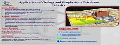
Applications of Geology and Geophysics in Petroleum Industry
More info
Geological concepts: traps, reservoirs, petroleum system, play concepts, seal types, fault seal analysis, types of geological maps. Geophysical methods to identify Basin areas, seismic surveys, seismic acquisition and processing, seismic interpretation, depth conversion, integration with well logs and geological data. Prospect generation, ranking. OOIP estimates. Risk assessment

Integration of Geology and Advanced Seismic Interpretation
More info
Explanation of plays and relation to geological complexities. Analysis of geophysical data contents and identifying limitations of quality. Preparation of efficient and objective seismic interpretation workflows. Pre-conditioning of seismic data volumes before running attributes. Creation of parameters testing criteria. Selection of suitable attributes relevant to geological settings and data quality limitations. Mapping, modelling visualization of geophysical results and correlation to geological facts. Quantitative geophysical assessment
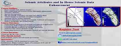
Seismic Attributes and In-House Seismic Data Enhancement
More info
Basic concepts Multiattribute display. Spectral decomposition. Geometric attributes. Dip and azimuth. Coherence. Curvature and reflector shape. Lateral changes in amplitude and pattern recognition Attributes and the seismic interpreter. Structural deformation. Clastic environments. Carbonate environments. Shallow stratigraphy and drilling hazards
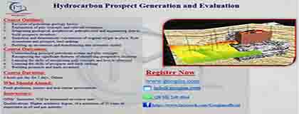
Hydrocarbon Prospect Generation and Evaluation
More info
Revision of petroleum geology basics. Explanation of paly concepts and relevant evidences. Integrating geological, geophysical, petrophysical and engineering data to build prospects inventory. Statistical and deterministic calculations of original oil/gas in place. Risk assessment and prospect, lead ranking.

Fundamentals of Seismic Data Processing
More info
Fundamentals of signal processing, Principal processes — deconvolution, CMP stacking, velocity types and analysis, migration techniques and the noise and multiple attenuation techniques. Processing of 3D seismic data. Preparation, submission, evaluation of processing tenders. Follow up and QC on seismic processing projects

Introduction to Oil and Gas Business
More info
Definition of main industry features, upstream, midstream, downstream. Explanation of petroleum reserves and classifications. Business models for upstream industry. Agreements and contracts
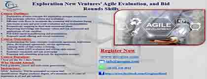
Exploration New Ventures' Agile Evaluation, and Bid Rounds Skills
More info
Course Outlines: Explanation of basic concepts and definitions that are frequently utilized for exploration acreages acquisition campaigns Data packages selection criteria and evaluation Efficient work flows to accelerate the screening and evaluation during data rooms events Post event potentialities evaluation and recommendations Prospectivety mapping in short term assessment phase Expressing knowledge into business values Risk assessment and applications of risk variables Full G&G report manufacturing and presentations Proposals smart offering and crucial constraints Course Outcomes: Understanding the basic concepts (concession agreement, exploration phase, development agreements, service agreements, oil in place, recoverable oil) data rooms screening, smart G&G evaluation and writing agile reports Extracting a realistic and effective geological model Economic constraints and risk assessment Preparing and submitting proposals for an acquisition of exploration acreages

Oil and Gas Agreements and License Application
More info
Introduction to petroleum reserves classifications and relevant field categories. Types of agreements, exploration, development production sharing and service agreements. Assets' evaluation and reserve estimates. Preparation of proposals. Contracts terms and commitments
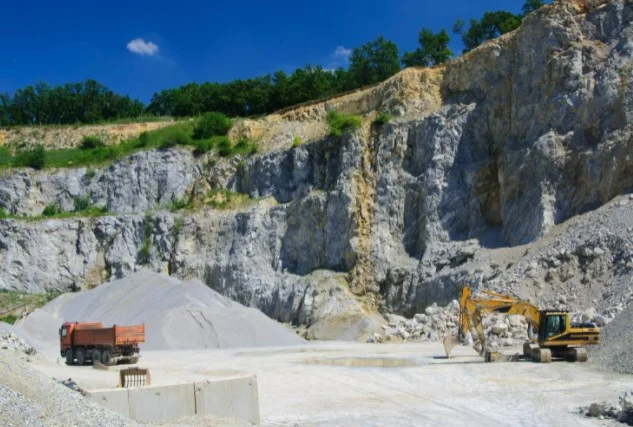
 Minerals Exploration and Mining Management
.webp)
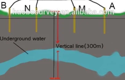
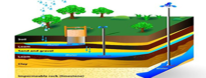 Undergroung Water

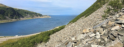 Enviromental

 Engineering